NASA Features Lunar South Pole De Gerlache-Kocher Massif in APOD
NASA highlights the De Gerlache-Kocher Massif in its November 7 Astronomy Picture of the Day, spotlighting high-value lunar terrain for polar exploration.
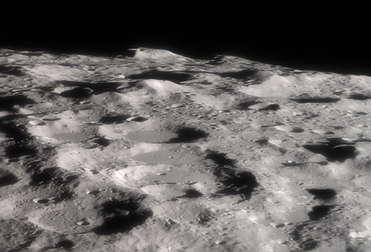
The National Aeronautics and Space Administration (NASA) featured the De Gerlache-Kocher Massif in its November 7, 2026 edition of the Astronomy Picture of the Day (APOD), highlighting one of the most prominent geological formations near the lunar south pole. Published through NASA News Releases and the agency's science communications division, the daily dispatch presents high-resolution astronomical imagery accompanied by technical commentary curated by professional astronomers. The selection of the De Gerlache-Kocher Massif underscores ongoing scientific and operational focus on rugged lunar polar topography.
For the global space enterprise, aerospace contractors, and commercial lunar payload providers, high-precision imaging of the lunar south pole carries direct operational significance. Topographical features such as the De Gerlache-Kocher Massif sit at the intersection of sustained solar illumination and permanently shadowed craters. Detailed cartographic and visual documentation of these elevated massifs informs landing site selection, surface rover navigation, line-of-sight telecommunications architecture, and resource utilization planning for upcoming robotic and crewed lunar missions.
Scientific Curation and Lunar Cartography
The November 7 publication continues the core mandate of the Astronomy Picture of the Day archive, which catalogs significant celestial and planetary phenomena for both the scientific community and the public. According to the official program overview accompanying the release, the platform is designed to document the cosmos through daily observational records.
"Each day a different image or photograph of our fascinating universe is featured, along with a brief explanation written by a professional astronomer."
Within this archival framework, featuring the De Gerlache-Kocher Massif places emphasis on lunar reconnaissance data. Located in the rugged southern polar highlands, massif structures are steep-sided mountain blocks formed by ancient impact basin tectonics. Because the Moon has a minimal axial tilt relative to the ecliptic plane, elevated ridgelines along the De Gerlache-Kocher Massif receive extended periods of oblique sunlight, contrasting sharply with adjacent valley floors and crater interiors that remain in perpetual shadow.
Operational and Technological Impact on Polar Missions
From an engineering and mission-planning perspective, topographical analyses of the De Gerlache-Kocher Massif directly influence hardware tolerances and surface operations architecture. Aerospace systems operating in the lunar south pole environment must contend with extreme lighting gradients, where low-angle solar rays cast long shadows across boulder fields and steep inclines. High-resolution imagery distributed through NASA science channels supports hazard-detection algorithms, optical navigation databases, and terrain-relative landing systems required by commercial lunar landers and orbital reconnaissance platforms.
Furthermore, the elevation profile of the massif presents strategic advantages for surface infrastructure. Peaks and ridgelines across the De Gerlache-Kocher region are evaluated by mission planners for their ability to support solar power arrays and direct-to-Earth radio communication relays. In contrast, the nearby permanently shadowed regions act as cold traps capable of preserving volatile compounds, including water ice, which remain central to long-term in-situ resource utilization (ISRU) models and deep-space propellant production economics.
Strategic Outlook for Lunar Frontier Operations
As international space agencies and commercial aerospace firms advance their lunar exploration timelines through the latter half of the decade, public and scientific releases detailing specific south polar landmarks like the De Gerlache-Kocher Massif will remain vital to mission readiness. Continued integration of orbital imaging, altimetry, and astronomical commentary will refine surface mobility protocols and reduce operational risk as capital deployment toward cislunar infrastructure accelerates.